NWS Jacksonville@NWSJacksonville36mA special weather statement has been issued for Homerville GA, Pearson GA and Argyle GA until 10:45 AM EDT208208
NWS Jacksonville@NWSJacksonville46mA special weather statement has been issued for Blackshear GA, Nahunta GA and Patterson GA until 10:30 AM EDT213213
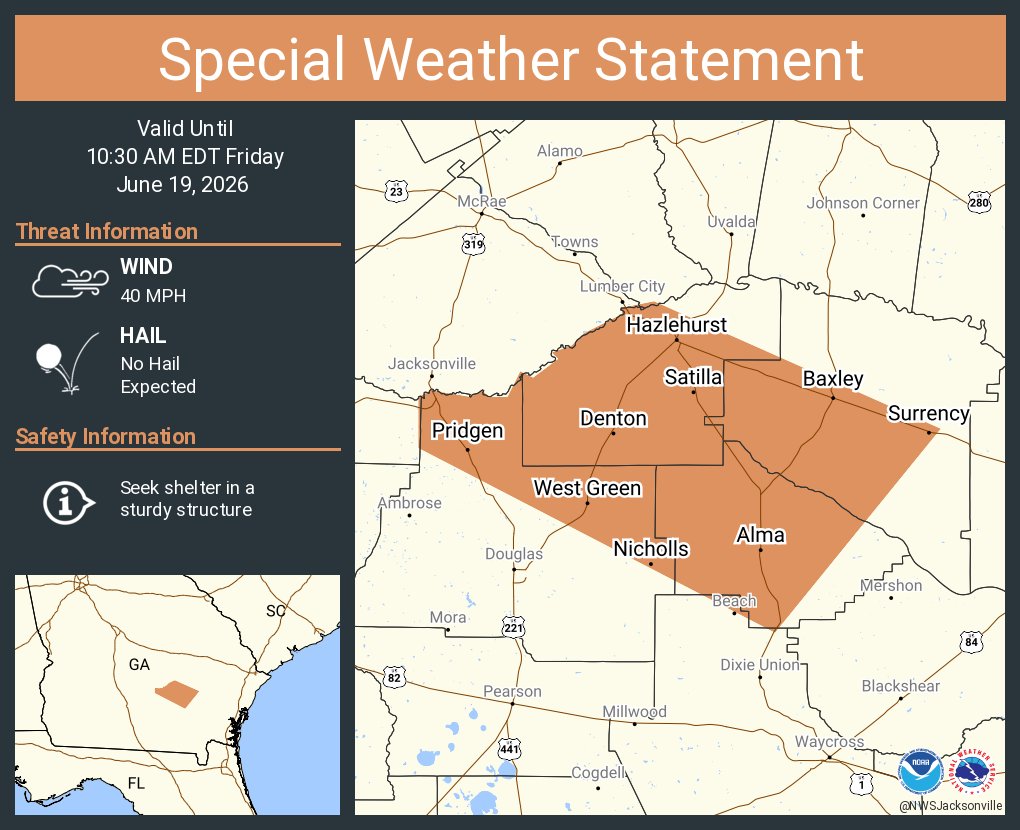
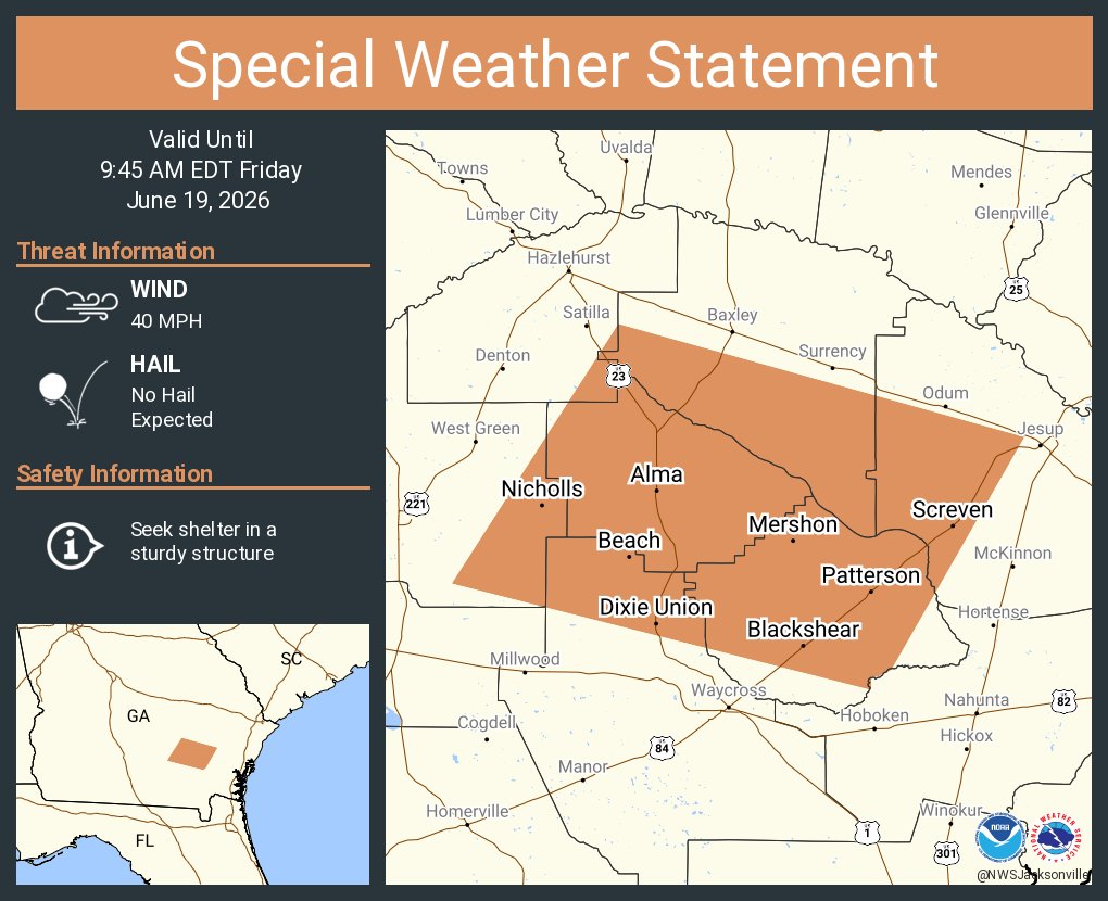
NWS Jacksonville@NWSJacksonville47mA special weather statement has been issued for Baxley GA, Hazlehurst GA and Alma GA until 10:30 AM EDT224224
NWS Jacksonville@NWSJacksonville1hA special weather statement has been issued for Brunswick GA, Saint Simons Island GA and Arco GA until 10:00 AM EDT281281
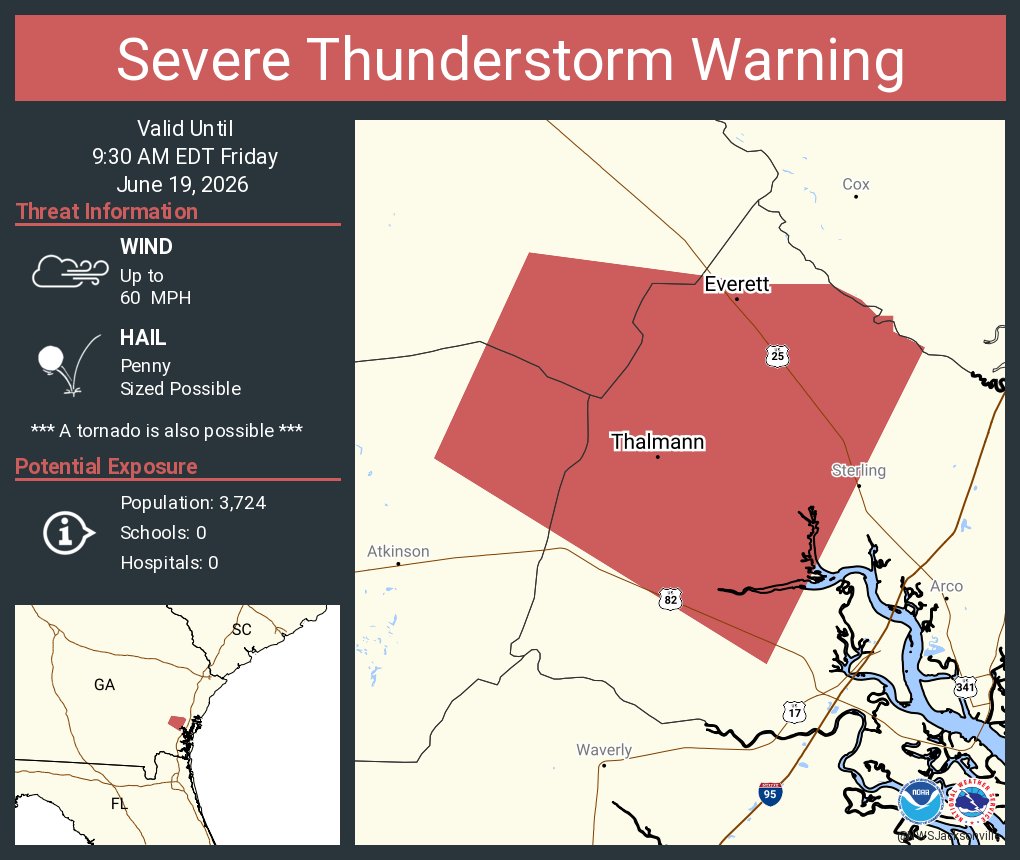
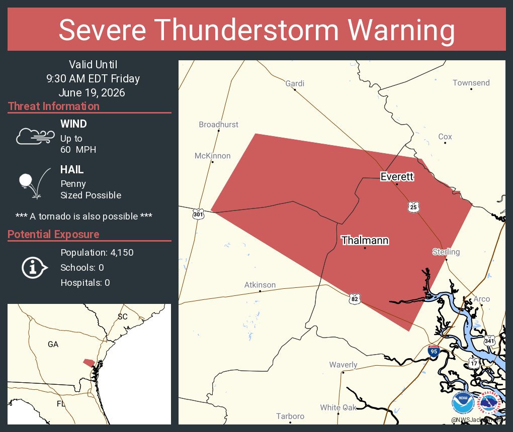
NWS Jacksonville@NWSJacksonville1hSevere Thunderstorm Warning continues for Everett GA and Thalmann GA until 9:30 AM EDT320320
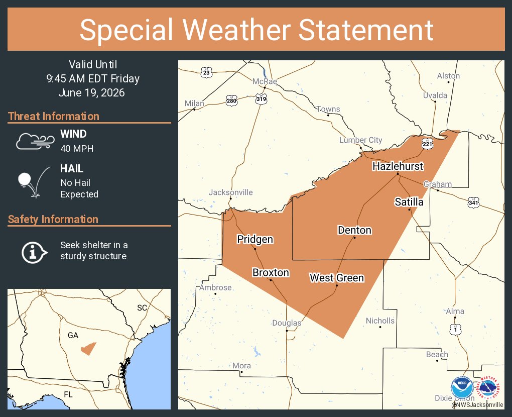
NWS Jacksonville@NWSJacksonville1hA special weather statement has been issued for Hazlehurst GA, Broxton GA and Satilla GA until 9:45 AM EDT275275
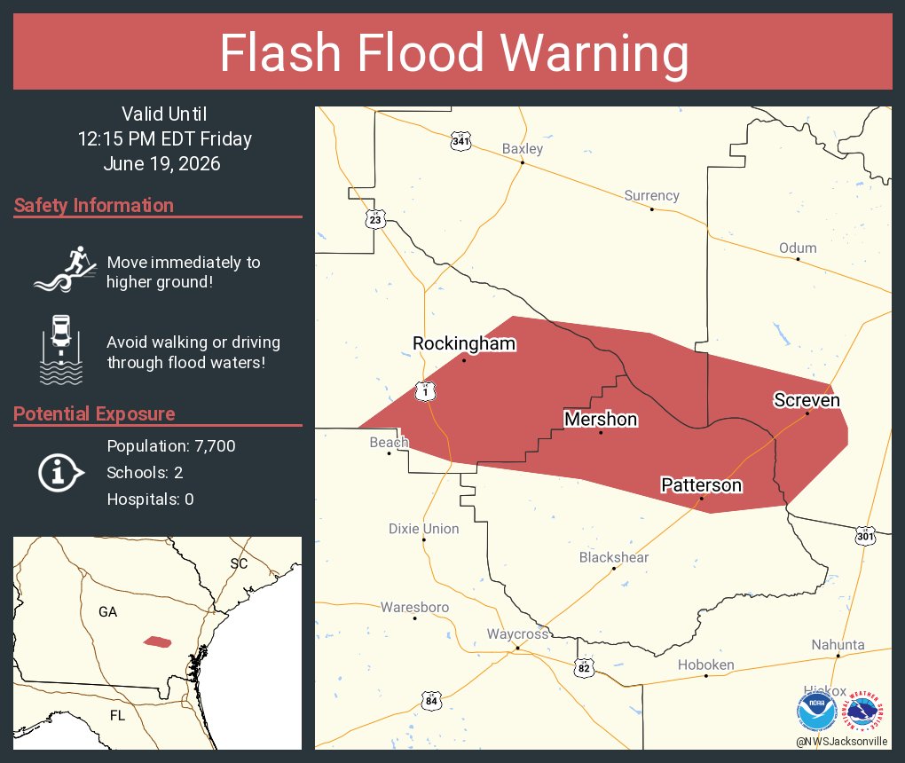
NWS Jacksonville@NWSJacksonville1hFlash Flood Warning including Screven GA, Patterson GA and Offerman GA until 12:15 PM EDT288288
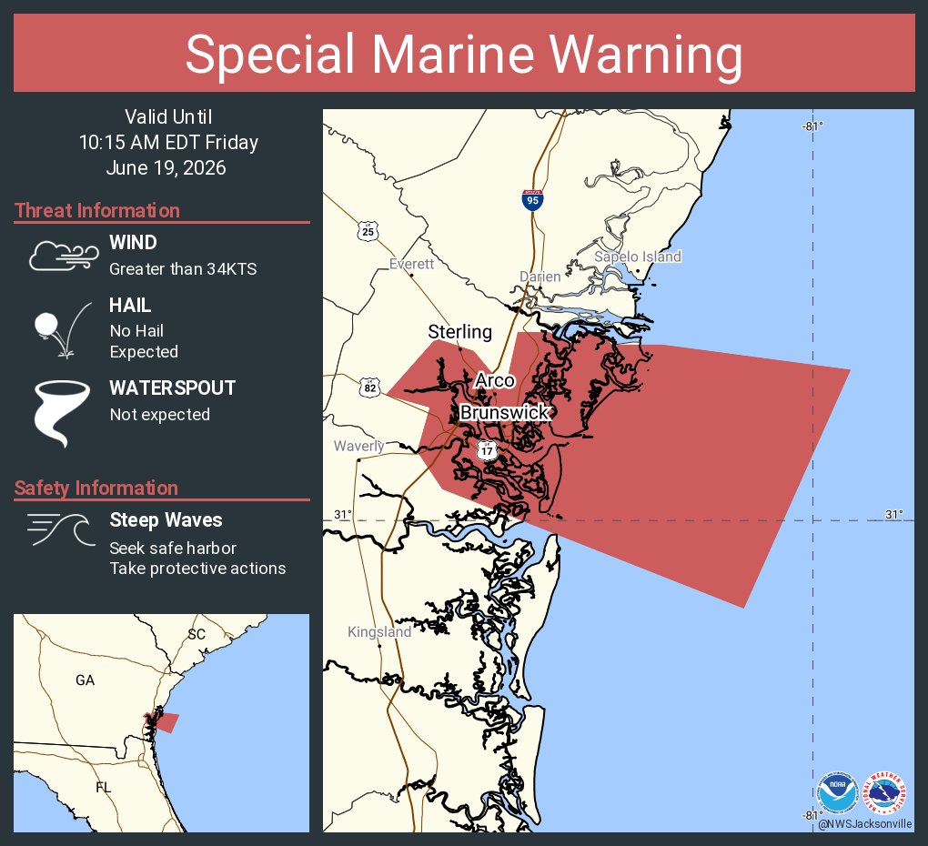
NWS Jacksonville@NWSJacksonville1hSpecial Marine Warning including the Coastal waters from Altamaha Sound to Fernandina Beach FL out 20 NM until 10:15 AM EDT298298
NWS Jacksonville@NWSJacksonville1hA special weather statement has been issued for Alma GA, Blackshear GA and Nicholls GA until 9:45 AM EDT280280
NWS Jacksonville@NWSJacksonville1hSevere Thunderstorm Warning including Everett GA and Thalmann GA until 9:30 AM EDT289289
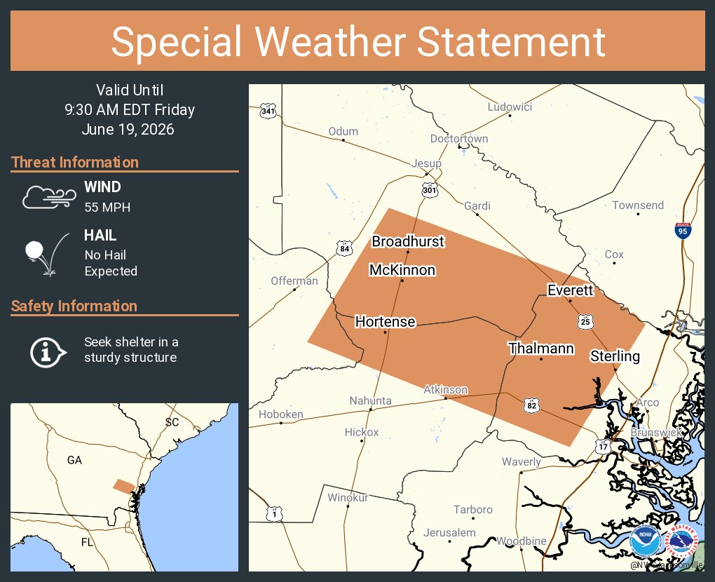
NWS Jacksonville@NWSJacksonville1hA special weather statement has been issued for Broadhurst GA, McKinnon GA and Sterling GA until 9:30 AM EDT299299
NWS Jacksonville@NWSJacksonville2hFlash Flood Warning including Alma GA, Nicholls GA and Rockingham GA until 10:30 AM EDT335335
NWS Jacksonville@NWSJacksonville2hA special weather statement has been issued for Alma GA, Blackshear GA and Screven GA until 9:00 AM EDT11351351