
 California Highways:
[Click here for a key to the symbols used. Some county routes were constructed with federal funds. These routes are indicated as FAP (Federal Aid Primary), FAU (Federal Aid Urban), or FAS (Federal Aid Secondary). If no funding source is shown, no federal funds were used. Note that while some segments seem to have the same attributes, they may differ in the county-local road number assigned to the segment, or in the Caltrans Map Sheet number.]
 Routing
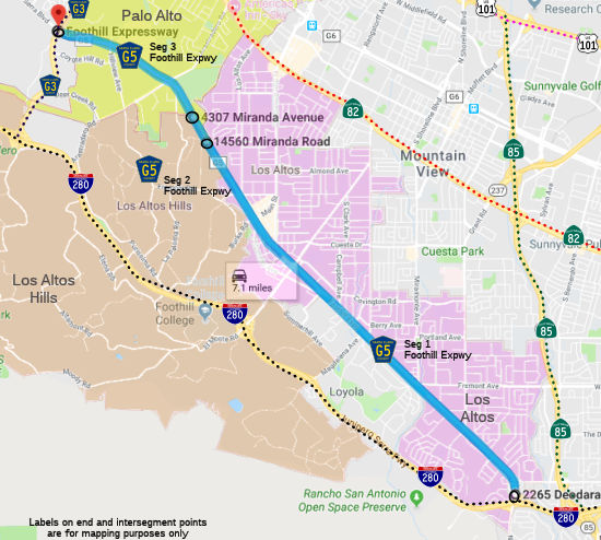 Foothill Expressway in Los Altos from I-280 to the Los Altos city limits (FAU, 4.84 mi)
Foothill Expressway from the Los Altos city limits to the Palo Alto city limits (FAU, 0.30 mi)
Foothill Expressway in Palo Alto from the Palo Alto city limits to Page Mill Road (County Sign Route G3). (FAU, 2.10 mi)
 Other WWW Links
 History and Signage Information
This route was defined in 1962.
The route was constructed on the former right of way of the SP San
Francisco-Los Gatos line. On March 21, 1962, SP filed with the ICC for
permission to discontinue the trains and abandon 6.27 miles of track from
Alta Mesa (in Palo Alto) S to Simla (in Cupertino), so that the Santa
Clara County Highway Department could build the Foothill Expressway on the
right of way. The ICC granted that in late 1963. On Monday, Jan. 27, 1964
the last scheduled passenger train ran on the historic Vasona Branch. The
US District Judge did forbid SP from removing the track pending a review
of the controversial abandonment by another judge. Ultimately, SP and
Santa Clara County prevaled. The Los Altos Branch was abandoned between
California Avenue and Simla on June 30, 1964.
(Source: SP Trainline, Winter 1964, via email from Mike Palmer)
 Status
Total mileage: 7.24 mi.
© 1996-2024 Daniel P. Faigin.
Maintained by: Daniel P. Faigin
<webmaster@cahighways.org>.

 CR G4
CR G4 CR G6
CR G6